Appendix 5:
The Spatial Distribution of Afghan Civilian Casualties Caused by the U.S Air War, October 7 - December 6th.
The following maps present the cumulative distribution across Afghanistan of civilian casualties caused by the U.S. air war. As expected, the greatest toll occurred mostly in the regions of highest population density---Kabul, Jalalabad and Kunduz. Not surprisingly, the area around the Taliban's spiritual headquarters, Kandahar, was also heavily hit.
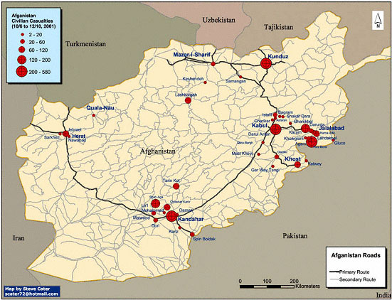
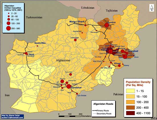
The maps were produced by Steve Cater, using the data from my Appendix 4 [available at http://www.cursor.org/stories/casualty_count.htm, or at http://pubpages.unh.edu/~mwherold/afghanistan-new.xls ].
Cursor
homepage